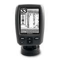
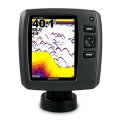
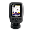
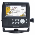
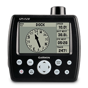
Garmin GPS 152Hi
 Klik untuk memperbesar |
Tidak ada gambar tambahan untuk produk ini.
|
Get quality trackplotting with the high-sensitivity GPS 152H, a grayscale trackplotter with easy-to-use features that fits both your boat and your budget.
Acquire Satellites Quickly
The GPS 152H features a high-sensitivity GPS receiver, an internal GPS antenna and a built-in BNC connector for an optional external antenna connection to ensure that you acquire satellite signals quickly, regardless of your position. It also can receive position corrections from the Wide Area Augmentation System (WAAS), which makes its already-accurate positioning data even more reliable. In fact, when you turn on WAAS, you can increase the accuracy of the 152H's position reporting to within 3 m (9.84 ft).
Store More Important Data
With an increased memory, the GPS 152H can store up to 3,000 waypoints and 50 routes. And the 4" (10.16 cm) diagonal high-contrast display makes it easy to see and navigate to waypoints or other places. We've also added a NMEA 0183 output so you can send position data to another electronic device on your boat.
![]()
SPECIFICATIONS:
Physical & Performance |
||
| Unit dimensions, WxHxD | : | 5.3" x 4.9" x 2.4" (13.4 x 12.5 x 6.1 cm) |
| Display size, WxH | : | 3.5" x 2.3", 4.0" diagonal (8.9 x 5.8 cm, 10.2 cm diagonal) |
| Display resolution, WxH | : | 160 x 100 pixels |
| Display type | : | 4-level grayscale LCD |
| Weight | : | 1 lb. (454 g) |
| Battery | : | none |
| Battery life | : | none |
| Waterproof | : | Yes (IPX7) |
| High-sensitivity receiver | : | Yes |
| Antenna | : | internal or remote |
| NMEA input/output | : | NMEA 0183 |
Maps & Memory |
||
| Basemap | : | No |
| Preloaded maps | : | No |
| Ability to add maps | : | No |
| Built-in memory | : | 1 MB |
| Accepts data cards | : | none |
| Waypoints/favorites/locations | : | 3,000 |
| Routes | : | 50 |
| Track log | : | 10,000 points |
Features & Benefits |
||
| Garmin radar compatible | : | No |
| Garmin sonar compatible | : | No |
| Garmin Marine Network™ compatible | : | No |
| Touchscreen | : | No |
| Supports AIS (tracks target ships' position) | : | No |
| Supports DSC (displays position data from DSC capable VHF radio) | : | No |
| Audible alarms | : | Yes |
| Tide tables | : | No |
| Hunt/fish calendar | : | No |
| Sun and moon information | : | Yes |
| 3-D map view | : | No |
| Auto Guidance | : | No |
| XM WX Weather & Radio for U.S. & Canada compatible | : | No |
| Automatic routing (turn by turn routing on roads) | : | No |
| Voice prompts (e.g. "Turn right in 500 ft.") | : | No |
| Speaks street names (e.g. "Turn right ON ELM STREET in 500 ft.") | : | No |
| Headphone jack/audio line-out | : | No |
| Audio/video input/output | : | No |
| Portable | : | No |
| Automotive/motorcycle-friendly | : | No |
- Bail mount and knobs
- Power/data cable
- Documentation

 Pencarian
 Online Chatt
 Merek
Merek Produk Promo

 Spesial Produk
 JNE Tracking
